Georgia is a country of diverse landscapes, natural wonders, and unique richness. That is why it has come to the attention of growing numbers of visitors over the last few years. Because of the wonderful location in the Caucasus mountains, the climate in Georgia is ideal for tourism.
Georgia offers tremendous variety. You will find rivers and the sea, mountains and cliffs, deserts and forests in different regions of Georgia. Hence, you can explore the national wonders for almost all four seasons of the year. Today I would like to introduce you to some of my favorite places in Georgia – some are already very popular and some are still out of focus and not so well-known. So you have the chance to be among the very few people to witness the hidden wonders of Sakartvelo (the native name for Georgia).
Jump to a section of this article
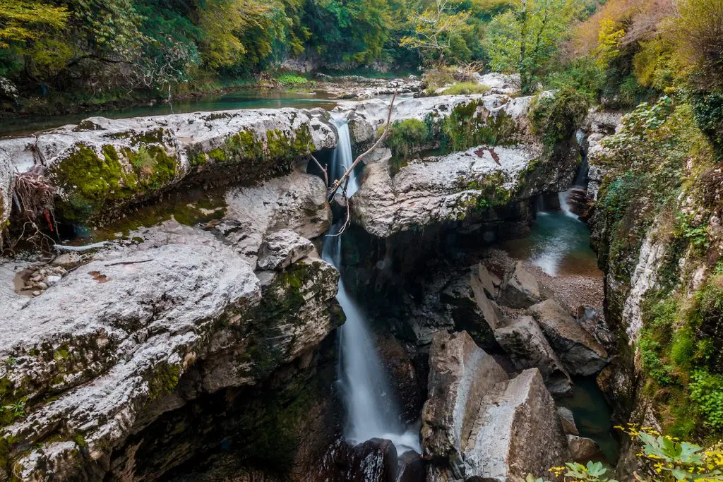
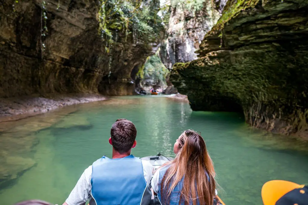
Martvili Canyons
Martvili Canyons is located in the Samegrelo Region and was created by the Abasha River which runs through and washes limestone rocks. The full length of the canyons is 2400 meters (around a mile and a half), the depth is 20 to 40 meters, and the width is five to ten meters. In the middle part of the canyon, there are 25-meter waterfalls and several natural “bridges”. All the more, traces of primitive people and prehistoric animals have been found in the area.
The Martvili Canyon consists of two parts: the upper and the lower. There is a pedestrian walkway with several small squares in the lower part of the canyon and at the top, it is possible to swim in the waters of the Abasha River.
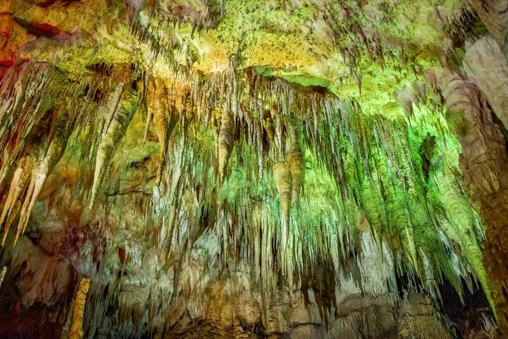
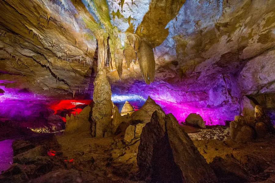
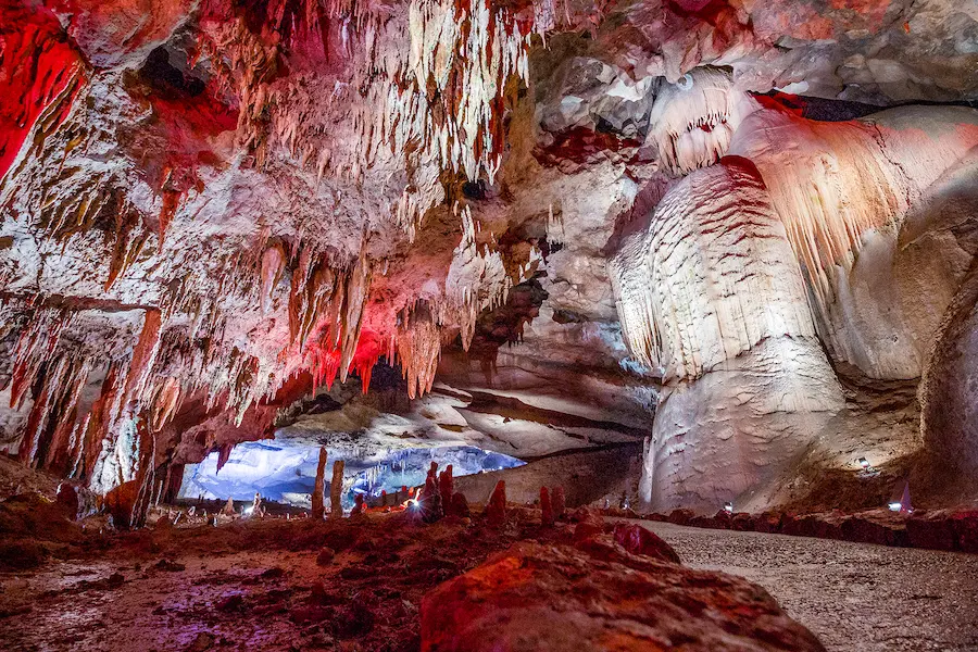
Prometheus Cave
The Karst Cave of Prometheus, also known as Kumistavi Cave, is located on the outskirts of the town of Tskaltubo. It is one of the most famous sights in Imereti and one of the biggest caves in Georgia. The overall length of the cave is around 11 kilometers, however, only around one kilometer is open for tourists. In contrast to many European caves, taking photos in Prometheus Cave is not prohibited. The cave looks very striking thanks to the beautiful light of the stalactites and stalagmites. The trail from the beginning of the hall to the end takes around 50 minutes.
Krubera Cave
Krubera Cave is located in the region of Abkhazia, in the Arabika Massif. It is the deepest cave on earth to date – 2190 meters deep with its entrance located about 2320 meters above sea level. The cave was first discovered by Georgian speleologists in 1960 who were able to explore up to 95 meters of its depth. Since its discovery, Krubera Cave has been visited each and every year by people who were trying to go deeper and reach the bottom.
Krubera Cave became the deepest cave on Earth only in 2001 when the Ukrainian Speleological Association reached 1,710 meters, which far exceeded the depth of the Lamprechtsofen Cave previously discovered in the Austrian Alps. In 2004, for the first time, a Ukrainian speleological group reached 2,000 meters – the deepest point that humans have ever been able to reach.
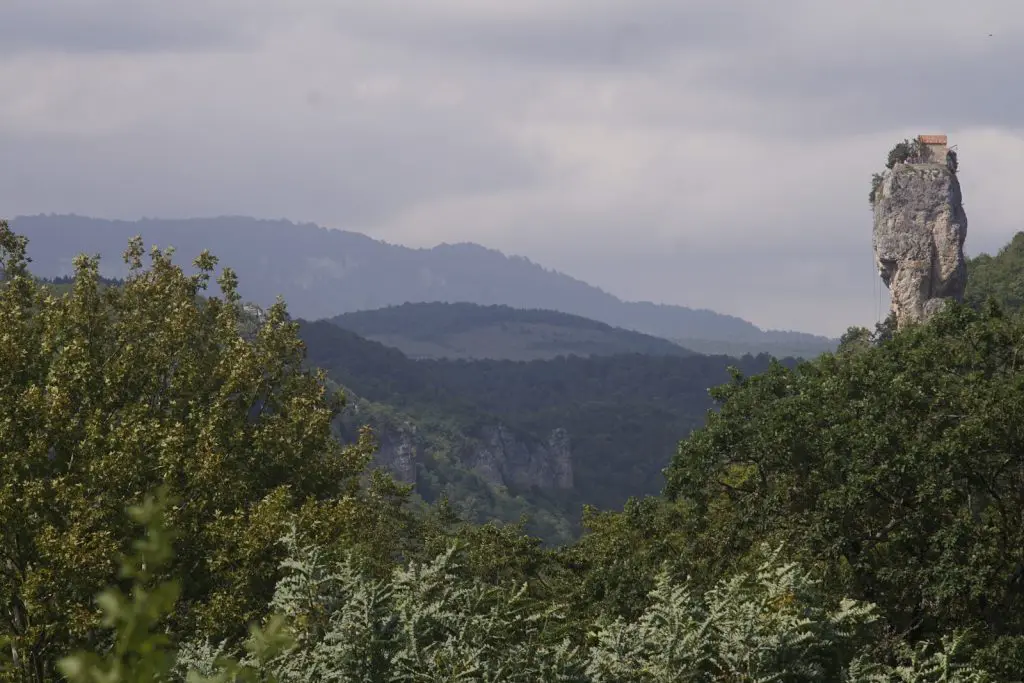
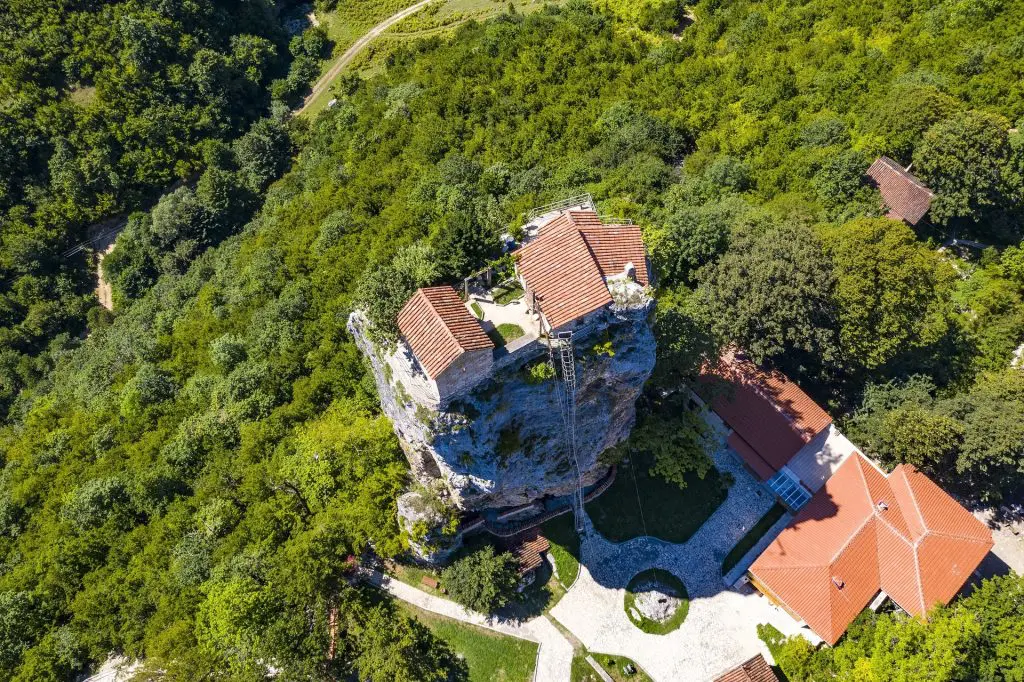
Katskhi Pillar
Katskhi Pillar is located in the Imereti region near the mining town of Chiatura. It is a historical monument of Georgia included in the “Red List” of endangered sites. Katskhi Pillar is a rock mass formed as a result of tectonic shifts and measures up to 45 meters. There is a church located on top of the pillar which is inhabited by local monks who, according to some historical sources, have lived here since the 6th century. It is possible to climb up to the church by using a 131-step iron ladder, but it’s not the easiest task. Currently, no one is allowed on the top of the Katskhi pillar except the church members.
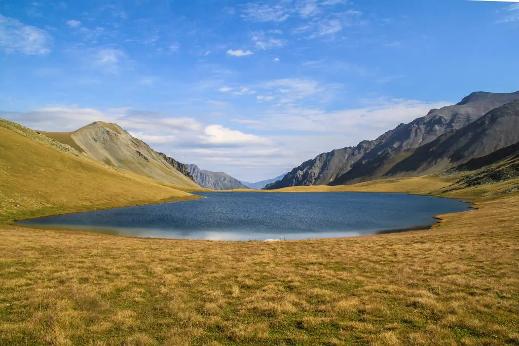
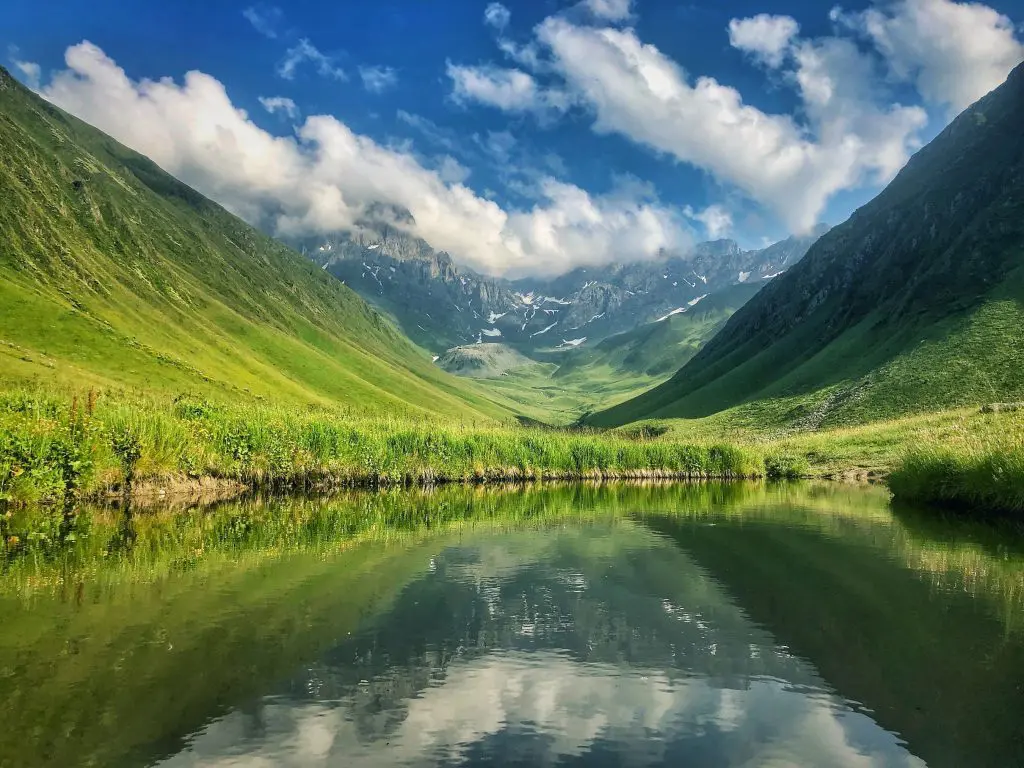
Black Rock Lake
Black Rock Lake is located in Lagodekhi Municipality, Kakheti at 2,800 meters above sea level. Its southern part is located within the borders of Georgia while its northern part lies on the territory of the Republic of Dagestan, Russian Federation. The lake feeds on snow, rain, and groundwater. The access path to the lake is one of the most diverse and interesting hiking routes in Georgia.
Along the way you will meet the virtually pristine nature of Lagodekhi Nature Reserve, the diversity of flora and fauna, the amazing views of the Alazani Valley and the Caucasus Mountains, the small lakes, swamps, and finally the beautiful lake between the rocks. In addition to the beautiful views on this trail, you may meet goats, elms, deer, grouses, Caucasian snowcocks, bearded vultures, and various eagles. This route is circular and its length is 42 kilometers.
Tobavarchkhili Lake
Tobavarchkhili aka Silver Lake is located in Samegrelo – Zemo Svaneti region. In addition to the lake, the road to it is unique not only in Georgia but also in all of Eastern Europe, because this is the place where you can simultaneously encounter caves, mineral waters, mossy massifs, as well as alpine lakes and waterfalls. The higher you go, the more impressive the environment becomes, the greenery increases after each meter, and you feel the beauty of the wildlife. After the car road ends travelers will have to walk in the beautiful forest, in case of fatigue, the shepherds’ huts they meet on the way are always ready to welcome guests.
Vashlovani Nature Reserve
Vashlovani Nature Reserve was established in 1935 and is located in the furthest eastern part of Georgia, in the Kakheti region. It stretches over 35,292 hectares and here you will find various landscapes of nature such as deserts, semi-deserts, meadows, and deciduous forests. Vashlovani Reserve contains 700 species of plants, some of which can be found only here. Fauna in Vashlovani Protected Areas is rich as well. There are 62 species of mammals, 135 species of birds, 30 species of reptiles, 20 species of fish, 4 species of amphibians, and 8 species of predators. Many of them are included in the “Red List” of endangered species.
Khvamli Mountain
Khvamli Mountain is located in the Racha-Lechkhumi region and stretches for 15 kilometers. The height of the mountain exceeds 2,000 meters above sea level. At an altitude of 1,700 meters, there is a freezer cave, where the temperature stays below zero degrees even during the summer heat, and there are always icicles hanging from the ceiling. From ancient historical sources, Khvamli is considered a mystical place where the Argonauts and Hercules have traveled. This is the mountain on which, according to legend, Prometheus was chained by the order of Zeus. The mystery of Khvamli Mountain attracts many and it is often visited by lovers of extreme tourism, as well as archaeologists and scientists.
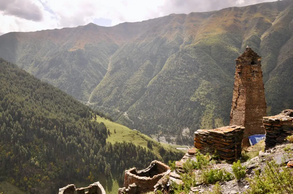
Tusheti National Park
Tusheti National Park is located in the Eastern Caucasus Mountains in Akhmeta Municipality, Kakheti Region, at an altitude of 900 – 4,800 meters above sea level. Its area is over 320 square miles and it was established in 2003. Tusheti National Park preserves alpine meadows, glaciers, peaks, river headwaters, rare and endangered species of animals and plants as well as a unique pine forest.
Tusheti National Park includes 11 tourist routes of different complexity, which allow on or multi-day hiking possibilities. Tusheti National Park is rich with its unique historical-cultural and natural landscapes and its visitors can choose among a lot of activities such as hiking, cycling, horseback riding, cultural, bird, and wild goat observation tours. Pine flowering is noteworthy, because of the great potential for Tusheti in terms of medical tourism.
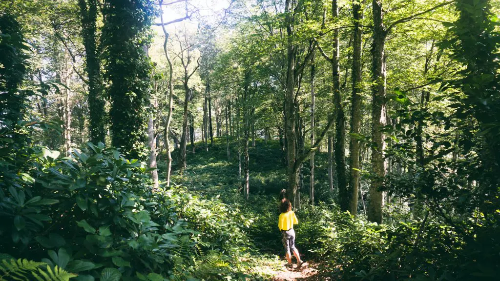
Mtirala National Park
Mtirala National Park is located in Adjara (famous for Adjaruli Khachapuri, the egg-boat bread), 25 kilometers from Batumi. The mountain with the same name, on which the park is located, rises to 1,761 meters above sea level. This place is considered to be the most humid place in Europe, as it is often shrouded in rain and thick fog. That is why the name of the mountain was given – “Mtirala”, which in Georgia means “crying”. Mtirala National Park is rich in tropical and subtropical flora and fauna. Single or multi-day tourist routes are available.
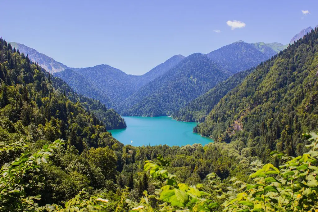
Lake Ritsa
Ritsi Lake is located in Abkhazia, at 884 meters above sea level. This large lake floating among the mountains covered with colorful forests is an amazingly beautiful sight and makes an unforgettable impression on the visitor. No matter the season of the year Ritsi Lake and its surroundings are always beautiful and charming. Water is green in spring and bluish during winter. The maximum depth of the lake is 116 meters – it is the deepest lake in the Caucasus and is joined by 6 rivers.
The lake was an important tourist attraction during the Soviet period and it was visited by up to 1000 tourists a day. Joseph Stalin himself had a summer cottage on the lake. Sadly Ritsi Lake is not easy to visit as it is located in the self-declared Russia-aligned Republic of Abkhazia.
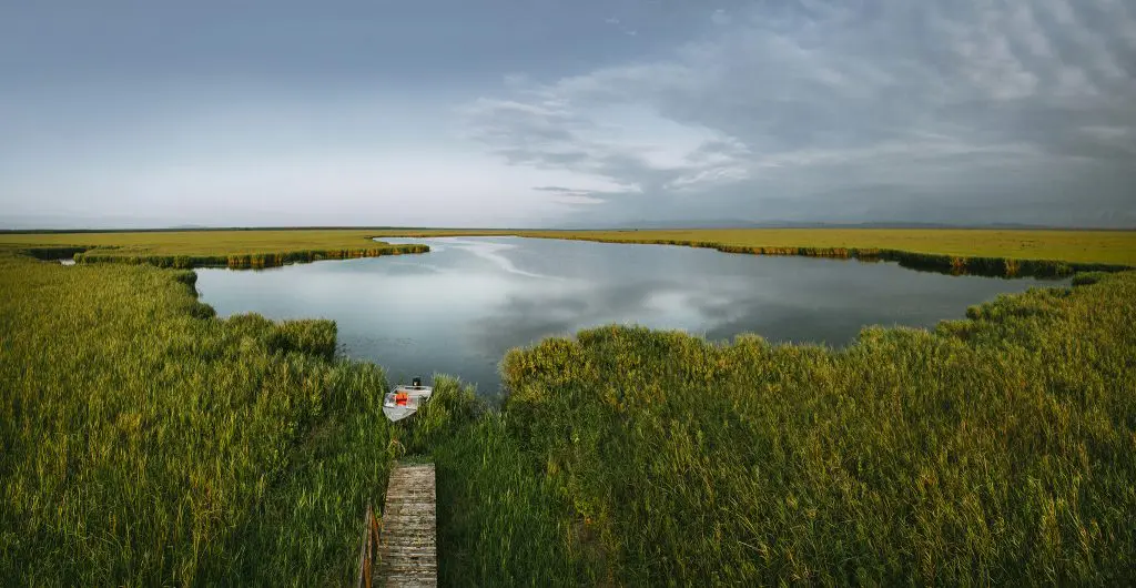
Kolkheti National Park
Kolkheti National Park was established in 1999, it is located in western Georgia. Its total area is 170 square miles and covers 5 districts of Georgia – Zugdidi, Khobi, Senaki, Abasha, and Lanchkhuti and it is part of two historical regions of Georgia – Samegrelo, and Guria. Kolkheti National Park belongs to the second category of IUCN-protected areas. The park is characterized by a high biodiversity of flora and fauna and an abundance of species of landscapes and ecosystems.
Visiting Kolkheti National Park is recommended all year round. It is possible to plan boating and kayaking on Paliastomi and Golden Lakes, and it is possible to visit the Colchis forest and unique swamps. In Kolkheti National Park, observation towers have been built in the park in order to observe more than 100 different species of migratory birds. In the auxiliary zone of Kolkheti National Park, it is possible to visit various important historical and cultural monuments such as Nokalakevi, Khobi Monastery, Dadiani Palace, and Rukhi Fortress.
Udziro Lake
Udziro Lake, or Bottomless Lake as it translates into English is located in Racha, Oni municipality, at 2,800 meters above sea level. It is one of the best places for hiking and adventure lovers. The bottomless lake trail is really distinguished by its beauty and diversity, and the lake offers amazing views. Green fields, the blue lake, cliffs, and white peaks reflected in the water make an indelible impression. The route is circular, the walking distance is about 18 km and it takes two days to pass it. The lake can be seen only in summer.
Chaukhi Massif
Chaukhi Pass is one of the easiest walking routes to cross the main ridge of the Caucasus. However, its simplicity is conditional and still requires good physical training. The charm of this route is that it is doable in one day, the traveler does not have to carry heavy loads and can arrive from one settlement in Juta (Kazbegi region) to another settlement in Roshka (Dusheti region) in one day. It is easy to find shelter in both of the places.
The Juta-Roshka route has long been marked on the world tourist map as one of the best in the Caucasus. The village of Juta is located twenty kilometers from Stepantsminda. It takes a little less than an hour to get there by car. Juta is 2,200 meters above sea level and it is one of the highest villages in Europe. On the top of the settlement, you will find the main attraction of the route – the marvelous Chaukhi Massif also referred to as the Dolomites of Georgia. Chaukhi is one of the favorite places of Georgian mountaineers and is often a base for mountaineering camps and festivals.
Okrotskali Lakes
Big and Small Okroktskali Lakes are located in Upper Svaneti, Mestia Municipality, on the border of Svaneti and Abkhazia. The Okrotskali Lakes route is one of the least known and at the same time one of the most impressive hiking routes. The pleasure of exploring the lakes and panoramic views overwhelms the effort required to see the lakes. The Big Okrotskali Lake is turquoise and leaves you with a feeling if you were on the beach, while the Small Okrotskali Lake water is darker in color. To reach the lakes you need to drive to the village of Lukha. The hiking trail starts 25 km from the village. A 25-kilometer stretch from the village of Lukha to the start of the trail can be covered by a 4×4 vehicle.
Dzudzuana Cave
A monument of world importance – Dzudzuana Cave is located in Chiatura Municipality, Imereti region. If, until now, it was believed that it was made by man 29 thousand years ago, excavations in Chiatura have proven that a man-made fabric first appeared 34 thousand years ago. The remains of the world’s oldest yarn have been found in the Dzudzuana Cave. Work on the Dzudzuana Cave has been carried out by a group of scientists since 1996, which includes not only Georgians but also American and Israeli specialists. The thread found in the Dzudzuana Cave confirms that 34,000 years ago man wore cloth clothes. This discovery caused a great response in the world. Flint and obsidian tools, animal bones, remains of primitive dogs and horses, etc. were also found here.
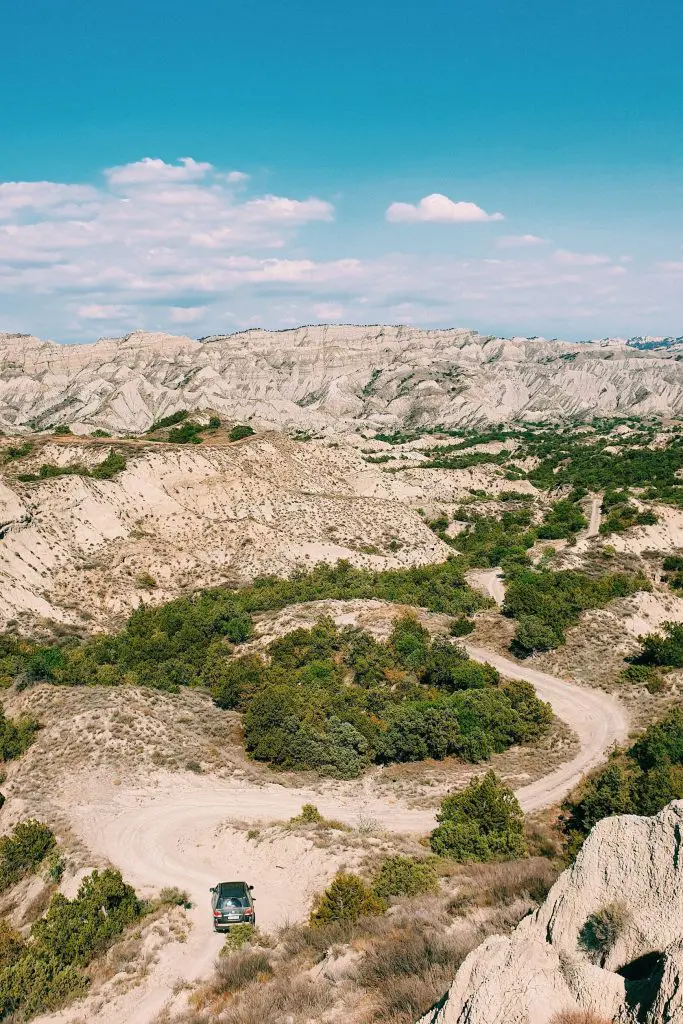
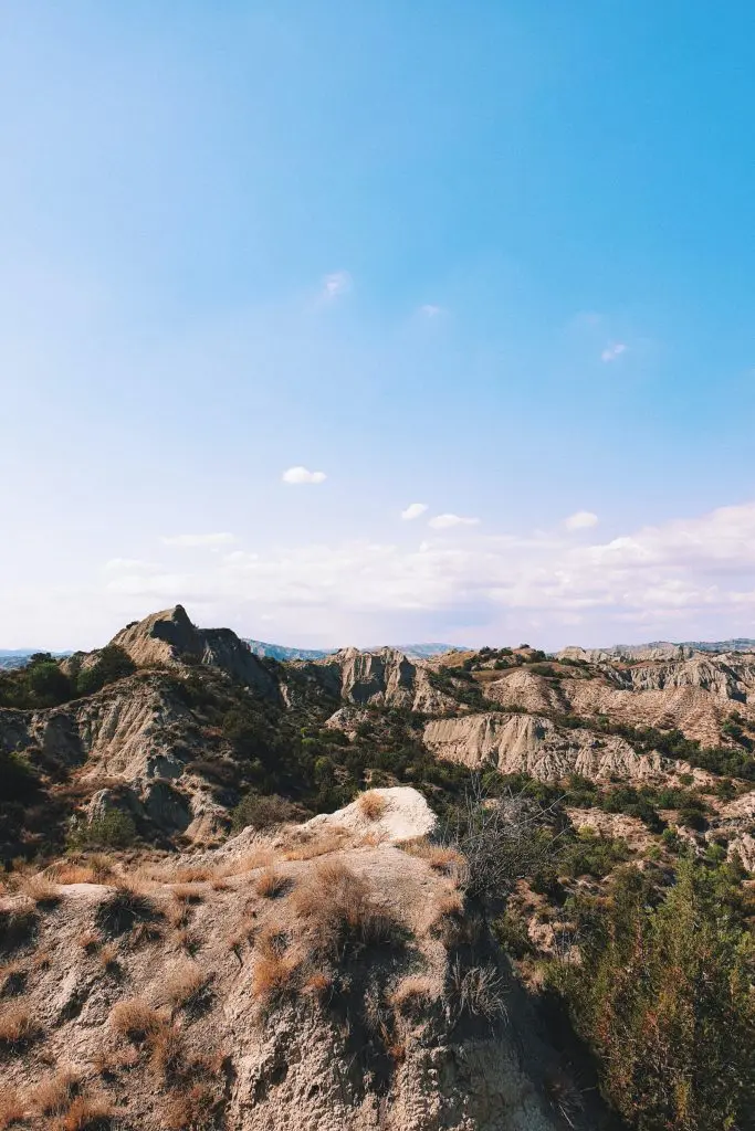
Mravaltskaro Colorful Mountains
Mravaltskaro Colorful Mountains are located in Kakheti, Gardabani municipality, at an altitude of 500-550 meters above sea level. It is a dry area of large hills and cliffs, with sparse vegetation. The place was called “Colorful Mountains” because of the differently colored rocks spread here. The colorful, striped mountains create an amazingly impressive and exotic spectacle. It is a unique place and attracts a lot of travelers. This place is beautiful during all four seasons, but especially in spring, when the various colors of the rocks are joined by the fresh greenery of the fresh grass which gives a more vibrant and contrasting color to the environment.

Gio was our man in Tbilisi, Georgia 2019-2022. Before coming to JayWay, Gio had already spent more than seven years in tourism, designing one of Tbilisi’s most popular tours, and learning how to show destinations from different points of view, revealing their hidden beauty. To better serve guests, Gio is fond of hiking beyond the city, especially in the mountains, or even taking part in extreme sports.